
The status bar can display different information. The information displayed depends on how Radio Mobile is configured. The visibility of the status bar is configured in 'View > Status Bar'
While navigating over the active map window the information at the mouse-tip is displayed in the status bar
Coordinates
In the menu 'options > coordinates' the type of coordinate that will be displayed can be selected.
Possible information te be displayed is:
| LAT-LON: |  |
| QRA: |  |
| X-Y |  |
Height
Height at the cursor is displayed in meters
Landcover
When in 'Options > elevationdata' 'include land cover height' is checked, the status bar also displays clutter type, and clutter height. (eg: Clutter = 15 m Evergreen Needle leaf.
|
|
Information also displayed:
In this example a 'left-click' is performed at any place in the active map window.
In the status Bar the information at that point is displayed: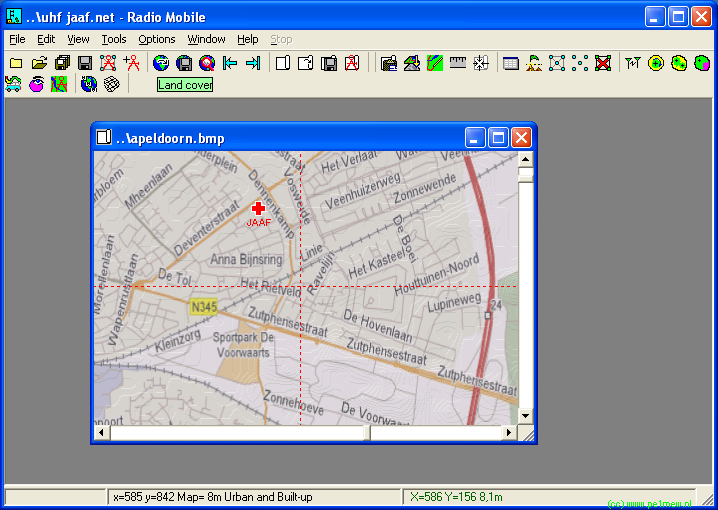
When the left mouse button is held from the point anywhere in thet current active window the distance and azimuth from the first click to the current point on the map is displayed in the third box of the Status Bar.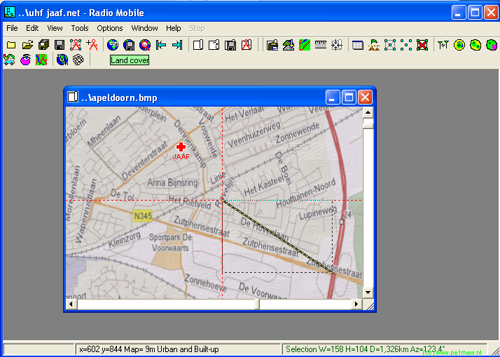
Using the 'shift-left-mouse button' a unit in the active window can be selected. A selected unit has the name 'bold' in the display: Unselected Unit
 Selected Unit
When the 'shift-left mouse button' is held from the point anywhere in the current active window the distance and azimuth from the selected unit to the current point on the map is displayed in the third box of the Status Bar.
