|
Radio Mobile - RF propagation simulation software |
|
|
|
|
|
This function changes the displayed coordinate system in both elevation grid and unit properties.
In the status bar it is selected which type of coordinate is displayed in the Status Bar. Using Geosys a alternative projection can be configured for MGRS.
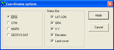
The available coordinate systems are:
- QRA (Maidenhead grid)
- UTM (Metric grid)
- MGRS
- system configured in geosys.dat.
Status Bar
Here the layout of the 'Status Bar' of the main window of Radio Mobile can be configured.
The information that will be displayed in the 'Status Bar' can be enabled or disabled by the check-box.
Information that can be displayed is:
- LAT-LON
- QRA
- XY
- Elevation
- Landcover
Elevation grid
Here are the possible coordinate systems displayed as used in the elevation grid:
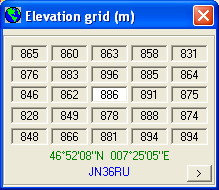 QRA QRA
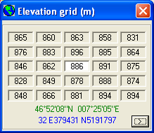 UTM UTM
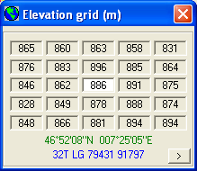 MRGS MRGS
|
|
| |
|
|
cmsimple-styles.com template modified by PE1MEW |
