Images that are saved from Radio Mobile are prepared for use in Google Earth. This is done by adding a file to the image that holds the geocoded information of the image for use in Google Earth. The extention for this file is KML.
This how-to describes how to create a coverage map in Radio Mobile and import it for analysis in Google Earth.
Radio Mobile
- Create a map of the area of interest using 'Map Properties' or the button:
 .
.
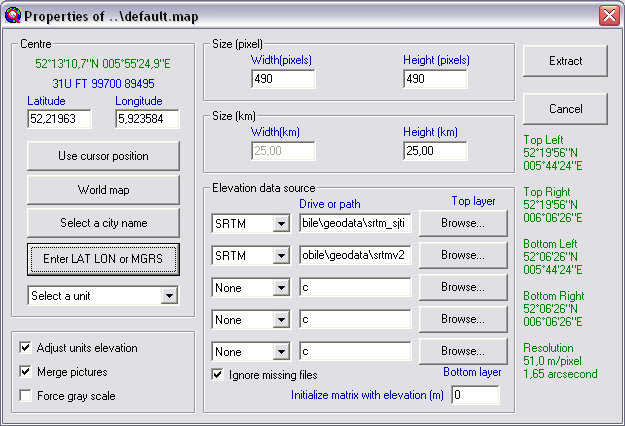
- Now we have to redraw the current map window with specific settings to enable transparency in Google Earth. Google Earth treats the colour white in a PNG file as transparent and does not display this 'transparent' color. To create a image that has a ahite backgound Contrast and Brightness have to be set to the right values.
Open 'Picture properties' or use the button: 
Change the values for Contrast to 0% and Brightness to 100%. and clich 'Draw'.
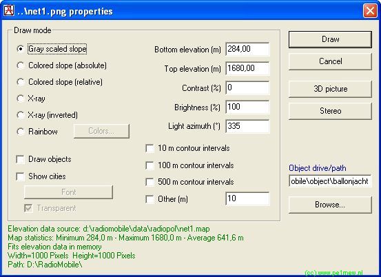
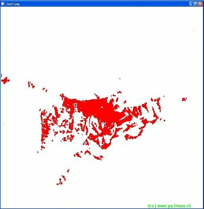
The result will be a map with white background.
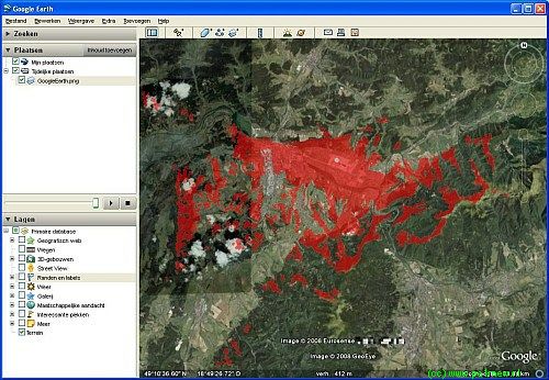
- On the white map we will create the analysis as required. This can be any analysis wich Radio Mobile can Perfom: Polar coverage, Cartasian Coverage, Interference coverage, Visual Coverage, etc.
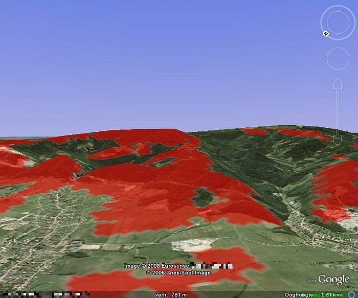
In our case we have created a polar coverage and displayed the area that meets the minimum criteria red.
- Export the map as a picture using 'File > Save picture as' and give it a appropriate name.
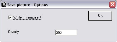
While saving the picture set transparency as white.
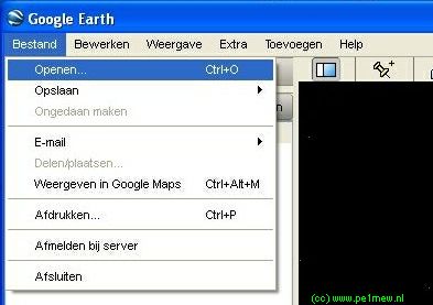
- Start Google Earth
- Locate and load the KML file that is associated with the in step 4 saved picture.
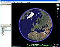
- Now the picture with the analysis will be loaded in to Google Earth and the main window will zoom in to the area wich is exported from Radio Mobile.
- Ready!
The nice thing about Google Earth that you can look to the world in perspective.
This helps a lot when analysing areas that you have not been your self: