|
It is important to have some background about DEM.
Generally we know from the GIS world 3-types of elevation data:
- Ground height
- Clutter height
- Composite height
SRTM data is of the last type. This is a brief description of how SRTM is composed and what the value is of SRTM.
Ground height
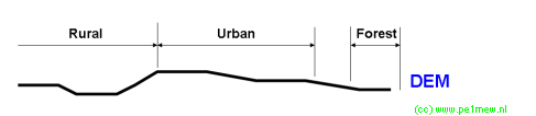
This image displays a example of ground height. generally flat terrain. This ground height is called DEM data.
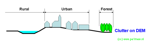
Clutter height
On the ground, another layer is put: The Clutter. This Clutter represents houses, forests, bushes, industry, you name it. This Clutter has it's own height and characteristics for RF signals. In Radio Mobile clutters comes as 'land Cover' The following image shows Clutter on the DEM:
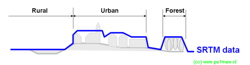
Composite data
As we know from studying the SRTM website we know that this data is obtained from scanning the earth surface with a radar. This radar does not have a very high resolution so we cannot see houses in the data. but we can see objects larger than 300x300 meters.
The result of the scanning is represented in SRTM data. As you can see SRTM data holds both ground height and clutter height.
Proof can be easily found using Radio Mobile.
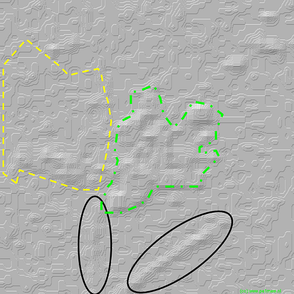
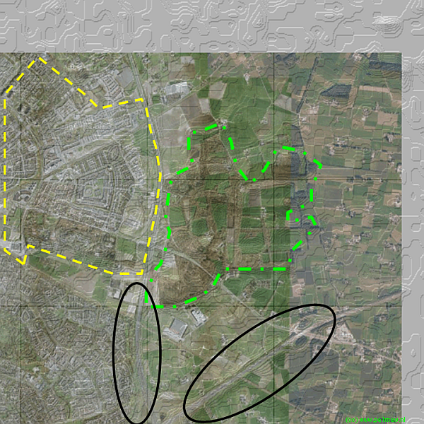
Practical example
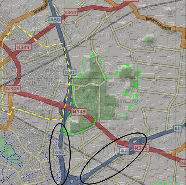
For this test I have taken a area I know well. In this area I have identified 3 locations.
- Highway on a wall (black circles)
- Forest area (Green dashed area)
- Urban Area (Yellow dashed area)
The areas can be seen in the following picture:
When we remove the map we still can recognise the mentioned areas in the SRTM data:
And finally to proof that SRTM holds the data a example of the same area using Google Maps:
Conclusion.
SRTM represents the sum of ground height and clutter height.
|
