|
 This function can be call using the [F5] key. This function can be call using the [F5] key.
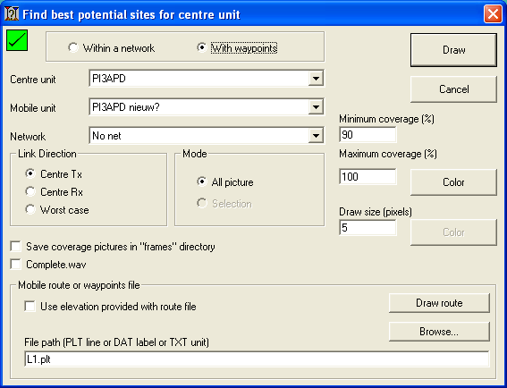
This function enables to determine the best location for a radio station that is able to reach all stations evaluated based on radio propagation. The best location can be determined within a Network of existing units or within a number of waypoints withn a waypoint file.
More information in the 'How to' on 'Find best sites using waypoints'
Best sites with way points.
To select 'using way points' check 'With way points'. now the extra menu to handle route or waypoint files appears.
Square indicator - top left
This indicator shows if Clutter or Landcover is included in the prediction.
 |
A red square with a cross indicates that Clutter (Landcover) is not enabled. |
 |
A Green square with a checkmark indicates that Clutter (Landcover) is enabled. |
Centre unit
Select the centre unit. generally here the base station is used. The centre unit can be configured in 'network properties' and the unit location and icon can be set in 'unit properties'
The Centre unit will be used for each bin that is evaluated.
Mobile Unit
Select the unit that will represent the mobile unit that will be positioned on each waypiunt in the route file. The mobile unit can be configured in 'network properties'
The mobile unit will be located on each pint in the way point file.
Network
Select a network to which both units are associated.
Mode
These functions are unknown now
All Picture
-
Selection
-
Minimum coverage (%)
Select here the minimum threshold for which the analyses will display the results.
Color
Select here the rainbow pallet the displays the ranges in % in the current map window
Sets the size of the bin in which Radio Mobile will calculate the radio path. Please read 'Defintions > Bin' on this topic because performance is affected by this parameter.
Color
Select the color of the bin
Save picture in "frames" directory
Radio Mobile has to analyse radio coverage for each position in the file provided in the File path. At the end of the analysis these individual analysis will be merged in a result that is drawn in the current map window.
Complete.wav
If checked Radio Mobile plays the file 'complete.wav' when the operation is finished.
Mobile route or waypoint file
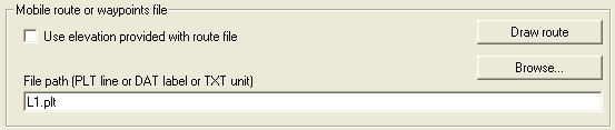
Use elevation provided with route file
If checked the elevation used in the file is used to replace the ground height form the DEM.
File path (PLT line or DAT label or TXT unit)
Displays the path and the file name which Radio Mobile will use for this analysis.
useable formats are line files in .plt format, label files in .dat format and units in .txt format. Follow the hyperlinks to a description of the individual formats.
When checked the individual analysis will be stored in a "frames" directory. The frames directory is allocated one level deeper than the folder in which the Radio Mobile executable is located. For each analysis a new frame folder is created with a number attached that will increase on each analysis.
Browse
Select the path and the file name which Radio Mobile will use for this analysis.
Draw route
Draws the selected route, labels or units in the current map window.
|
