|
Now you have Radio Mobile installed it is time to make a frst analysis. This how-to is based on the initial example of Roger coudé on his website. This first example will show the VHF coverage of my QTH (Roger). We need the coordinates of my QTH in this how-to for the unit representing my QTH.
My QTH is St-Jean-sur-Richelieu, Latitude 45° 16' - Longitude 73° 16'
1. Acquire elevation database from the internet
To be able to do propagation caclculations we need elevation data. You can use the elevation data as you have configured it in Radio Mobile.
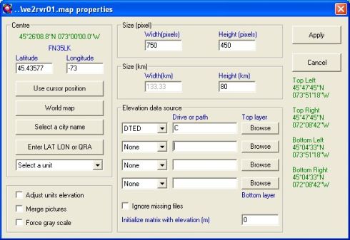
2. Extract elevation data and create a map picture
Launch Radio Mobile program. In "Files" menu, select "Map Properties", and enter the following values:
Click on the "Apply" button. Once data extraction is finished, the program will generate the following picture:
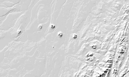
Use "Picture properties" to force "Gray scaled slope" mode.
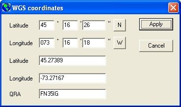
3. Position my QTH
Open "Unit properties" in the "Edit" menu and click on "Enter Latitude and Longitude". Fill as per the following:
Back to "Unit properties" insure that the unit is enabled and that a 38m elevation is shown before to apply, repeat for mobile:

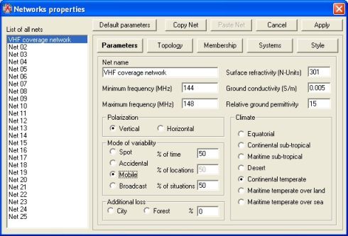
4. Enter Network data
Open "Network properties" in the "Files" menu and fill as per the following:
Net parameters tab:
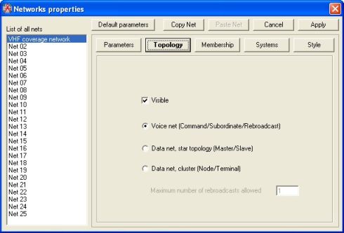
Net topology tab:
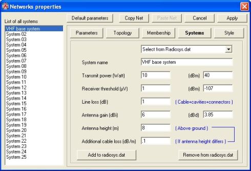
System tab for base:
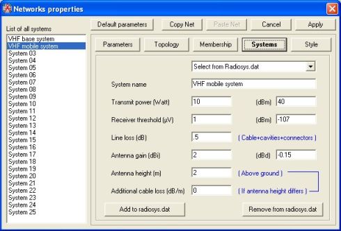
System tab for mobile:
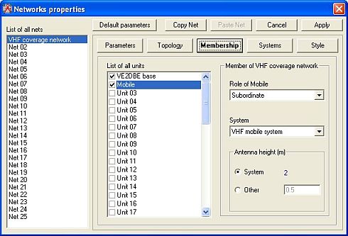
Net membership tab for base:

Net membership tab for mobile:
4. VHF Radio coverage!
In "View" menu, select "Radio coverage polar" and complete form as per the following:
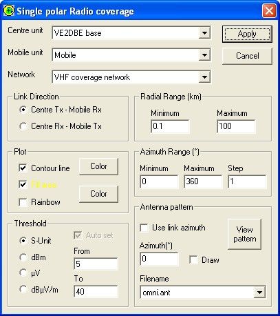
Click "Apply" button to obtain the resulting picture.
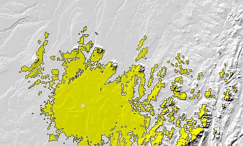
Congratulations with the result. Now you can find the coordinates of your favourite repeater and predict is't coverage.
|
