|
Radio Mobile - RF propagation simulation software |
|
|
|
|
|
Opens a window used to draw a custom defined elevation contour interval.
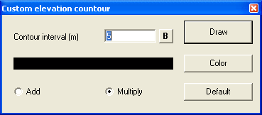
Contour interval (m)
Enter the interval in meters for the contour lines.
[B]-button
Toggles the line thickness. Bold is a thick line.
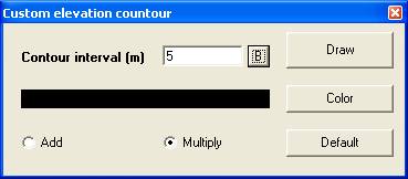
add / Multiply
The lines can be added or multiplied.
Color
Line colors can be set according your requirements.
Default
Restores all settings to default values.
Draw
Draws the contour lines as set on the current map window.
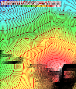
Example
A example where elevation contour is used in combined Bold and normal lines. Elevation cuntour is shown in 10 m interval with normal lines and 100 m interval with Bold lines.
|
|
| |
|
|
cmsimple-styles.com template modified by PE1MEW |
