|
Flood all map pixels surrounding cursor position that share the same elevation.
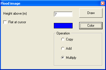
Flood can be set at the absolute terain level in meters or at all heights at the same level where the cursor is positioned.
Height above (m)
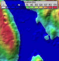
In this mode all levels below the set treshold will be flood. This is shown bij the following image.
Flat at cursor
Flat at cursor will flood all levels equal tot the heigth at the cursor. When a level is crossed by a valley or hill the other level will not be flood.
 To select a level click on the position with the cursor. To select a level click on the position with the cursor.
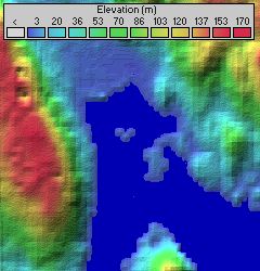
The following image shows all levels at 4 m which have been seleced by the cursor.
Draw
Will initiate the flood operation.
Color
Select the color that will be used for the flood operation.
Operation.
The method on how the color is added to the picture. This can be copy, add, or multiply.
|
