|
Radio Mobile - RF propagation simulation software |
|
|
|
|
|
Opens a window used to color a stratum of elevation.
 A Stratum can be interpreted as a layer. A Stratum can be interpreted as a layer.

Minimum elevation (m)
The minimum ground elevation height of the stratum in meters.
Maximum elevation (m)
The maximum ground elevation height of the stratum in meters.
Solid
Fill the boundarys of the stratum with the same color as the boundary lines.
Color
Line colors can be set according your requirements.
Draw
Draws the contour lines as set on the current map window.
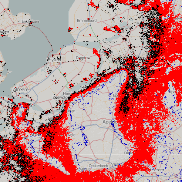
Example
The following image shows 3 stratum of elevations:
- Black is at 1 meter elevation
- Red is from 1 meter to 10 meter elevation (filled)
- Blue is at 20 meter elevation.
|
|
| |
|
|
cmsimple-styles.com template modified by PE1MEW |
