|
Radio Mobile - RF propagation simulation software |
|
|
|
|
|
Here you can set the level of detail that is displayed in the overlayed image. Also you can select the type of image you wisch to display:
- Roads,
- Hybrid
- Areal photo's
Examples of these maps are displayed at the end of this page.
 For more information about Google Maps look at 'Geodata > Google Maps' For more information about Google Maps look at 'Geodata > Google Maps'
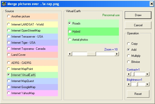
You can Copy, Add, Multiply, or bitwise overlay the selected source. See 'Merge pictures...'
The useage of Virtual earth is configured in the configuration file 'map_link.txt' which is located in the root of the Radio Mobile installation.
Examples
The following maps are produced by 'virtual earth':
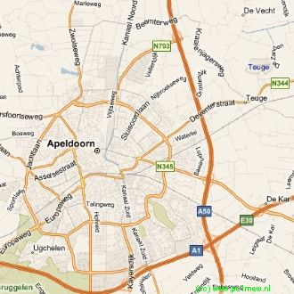 Roads Roads
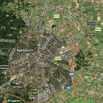 Hybride. Hybride.
|
|
| |
|
|
cmsimple-styles.com template modified by PE1MEW |
