|
||||||||||||||||||||||||||||||||||||||||||||||||||||||||||||||||||||||||||||||||||||||||||||||||
|
Ground conductivityArea specific data is in the table below. In the absence of any specific data, the default value should be used.
Relative ground permittivityThese properties determine together the nature of the radio wave reflection on the ground in a Line-Of-Sight radio link. In general, the more conductive the terrain is, the greater is the risk to have important attenuation or fluctuations of the radio signal. The worst case is the “picket fence” type. In the absence of any specific data, default values should be used.
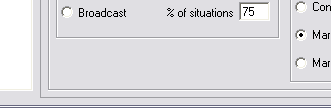
PolarizationEither horizontal or vertical (in accordance with the system in use). Mode of variabilityThe Mode of Variability settings modify the statistical margin value shown in Radio Link that is added to the link's path loss. As an example, for a local VHF packet data link select spot coverage. While varying the % of situations, the following statistial margins result for a particular link: 70% = 5.9 dB The Spot mode is for a one-try message. The Accidental mode is for interference evaluation. The Mobile mode is for units that are moving while communicating. The Broadcast mode is for stationary units.
ClimateThis option is used to select the type of climate mostly encountered in the selected deployment area. These options set some of the calculation parameters in the ITS algorithm used in the program. The atmospheric conditions like climate and weather vary in the different areas of the world, and affect both the refractive index of free air and play an important role in determining the strength and fading properties of radio signals. For instance, the refractive index gradient of air near the surface of the earth determines the way a radio ray is bent or refracted as it passes through the atmosphere.
Additional losshere additional compensation can be set for Forest or Urban environment. 'Land Cover useage enabled'
|
|||||||||||||||||||||||||||||||||||||||||||||||||||||||||||||||||||||||||||||||||||||||||||||||
|
||||||||||||||||||||||||||||||||||||||||||||||||||||||||||||||||||||||||||||||||||||||||||||||||