|
Things to know about the file format can be found at the 'File formats' on'Line objects', 'Polygon objects' and 'Label objects'.
In the 'how to' creation of objects like 'Line objects', 'Polygon objects' and 'Label objects' is described.
File
The file menu handles the object files. It also selects the type of operation in witch the object editor will operate: Handle line objects or handle label objects.
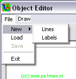
New > Lines
Switches the object editor to 'line mode' now lines can be created. for more information see 'how to - work with objects' The file format in which line objects are stored is described in 'object .plt file format'
New > Labels
Switches the object editor to 'label mode' now labels can be created. for more information see 'how to - creat label objects The file format in which line objects are stored is described in 'label object labels .dat format'
Load
Loads a object file and switches to the required mode.
Save
Saves the current file. For information on the file name look at 'How to > Work with objects' on how to name them properly.
Exit
exits the object editor
Draw
Draws the edited object on the current map window.
The object editor can work in 2 modes: Label editor and Line editor.
Label editor
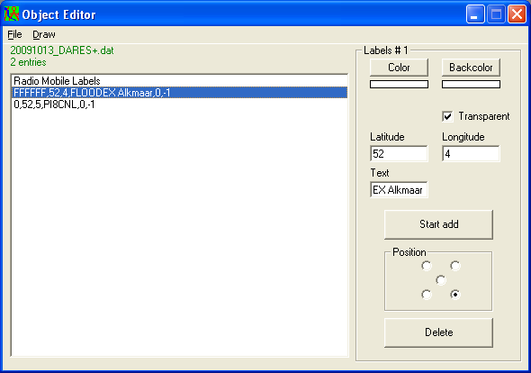
Labels #1
color
Select the text color as described in 'general functions > color'
Back color
Select the text backdrop color as described in 'general functions > color'
Transparent
If checked the Back color is not displayed
Latitude
latitude in degrees.decimal-degrees
Appears with the click of the mouse on the postion where a object is placed and can be manually changed.
Longitude
longitude in degrees.decimal-degrees
Appears with the click of the mouse on the position where a object is placed and can be manually changed.
Text
Text that should be placed at the label.
Position
Sets the position of the label around the coordinate.
0 = upper right
1 = upper left
2 = lower left
3 = lower right
4 = centre
Stop add
Stops adding objects to the current file
Position
Sets the position of the label with respect to the exact coordinate of the label.
Delete
Deletes the selected point(s)
Line editor
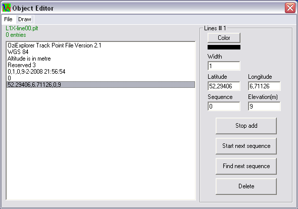
Lines #1
Color
Select the text color as described in 'general functions > color'
Width
Select the width of the line in pixels
Latitude
latitude in degrees.decimal-degrees
Appears with the click of the mouse on the position where a object is placed and can be manually changed.
Longitude
longitude in degrees.decimal-degrees
Appears with the click of the mouse on the position where a object is placed and can be manually changed.
Sequence
A line object file can hold more than one line. Each line is formed in a sequence. Here the secence is displayed.
Elevation
The height that comes from the DEM source in Radio Mobile
Stop add
Stops adding objects to the current file
Start next sequence
Start a new sequence
Find next sequence
jump to the first line point in the following sequence
Delete
Deletes the selected point(s)
|
