|
Opens a form in order to initiate visual horizon drawing.
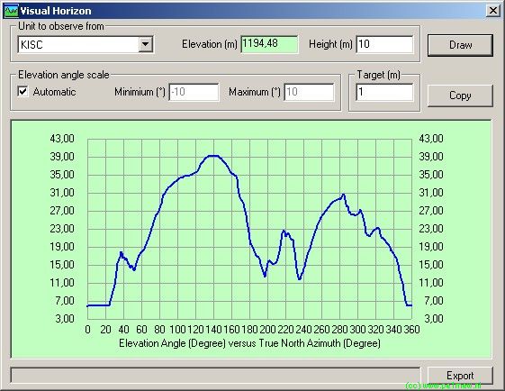
Unit to observe from
Elevation (m)
Groundheight in meters at the unit of observation location
Height (m)
Local height above ground of the 'antenna' of the unit.
Elevation angle scale
Automatic
If checked the minimum and maximum values at the Y-axis are based on the local situation.
If un-checked the minimum and maximum values at the Y-axis are set by the user.
Target (m)
Target hight above ground level in meters
Draw
Draws the Visual horizon graph
Copy
Copy's the Visual horizon to the clipboard
Graph
The Graph displays the maximum angle under which the observer unit can see the observed.
Export
Exports the Visual horizon to a text file 'horizon.txt'
Additional information.
The following image shows the situation of the unit under observation in the visual horizon above. the image can be used for verification of the result. As a aid radial lines have been drawn using 'Draw rings'
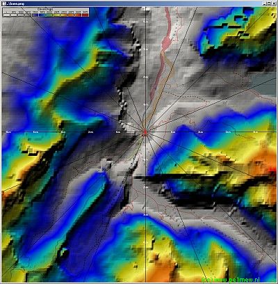 Click on the image for a large view Click on the image for a large view
|

