|
Radio Mobile - RF propagation simulation software |
|
|
|
|
|
The results of a radio link analysis can be exported to Google Earth using the export function in radio link.
After the export of the 'profile.kml' file Google Earth is opened automatically or manually. The 'profile.kml' file can be opened and Google Earth zooms to the radio link.
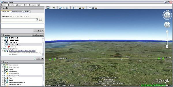
Click on the link 'Overview of radio link in Google earth' for the large image (Opens in a new window).
When the kml file in the temporary locations tab is opened specific details of the radio link are displayed. This information is the same as in 'radio link - Details'.

Presentation in Google Earth
Radio link
- This is displayed as a blue line. This is the straight line form the transmitting to the receiving antenna.
Fresnel zones
- A Green line shows 0.6F1 on the clearance side,
- A Yellow line shows 1.0F1,
- Other Fresnel zones will be shown in Red.
- The 0.6F1 and 1.0F1 lines are only shown where visible.
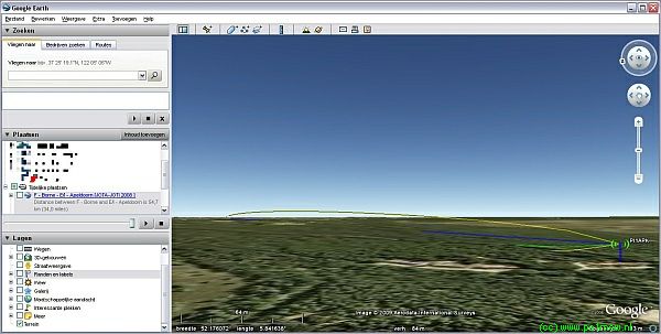
Click on the link 'Presentation radio link in Google earth' for the large image (Opens in a new window)
Image icon
The image icon that Radio Mobile is using is a PNG image. See 'antenna.png' for more information.
|
|
| |
|
|
cmsimple-styles.com template modified by PE1MEW |


